50 States, 50 Places & 50 Stories › Vermont
Vermont sample place
UVM Morgan Horse Farm & Middlebury/New Haven Glebe Lease Lot
Parcel at a glance
The University of Vermont (UVM) Morgan Horse Farm and its adjoining town lease-land lots sit above the falls of Otter Creek just north of Middlebury in Addison County (Towns of Weybridge and New Haven), inside 1761 Benning Wentworth New Hampshire Royal Charter Lots. Owned by the University of Vermont since 1951, this 400-acre historic farm and woodland corridor connects New England's royal township charters with a landmark U.S. Supreme Court public-trust case and Vermont's perpetual "Lease Lands."
The land before the survey
For thousands of years, the waterfalls of Otter Creek (Wonakakek) and the fertile clay-loam plains of the Champlain Valley were the homeland of the Western Abenaki people. Admitted in 1791 as the fourteenth state after fourteen years as an independent republic (1777–1791), Vermont has no federal rectangular survey grid. Instead, on November 2 and 3, 1761, Royal Governor Benning Wentworth of New Hampshire chartered the adjoining six-mile-square towns of Middlebury, New Haven, and Weybridge as part of the "New Hampshire Grants," and town proprietors hired surveyors to divide each town into numbered 100-acre rectangular lots.
First owners and the paper trail
Originally drawn by ballot by Connecticut and Massachusetts proprietors in the 1760s and resettled after the Revolutionary War, the limestone-sweetened pastures of Weybridge became the nineteenth-century capital of American Merino sheep and Morgan horse breeding. Between 1878 and 1907, publisher and conservationist Colonel Joseph Battell assembled the Weybridge farmstead to preserve the bloodline of Justin Morgan's foundation stallion Figure, built the ornate 1878 Victorian stallion barn, and donated the farm to the U.S. Department of Agriculture in 1907 before Congress transferred the property to the University of Vermont in 1951.
School-trust connection
Every 1761 Wentworth town charter in Vermont divided the township into roughly 68 equal proprietary shares and reserved four public trust shares in perpetuity: one share for Town Schools, one for the First Settled Minister, one as a Church of England Glebe, and one for the Society for the Propagation of the Gospel (SPG). When the Vermont Legislature passed statutes in 1794 and 1805 confiscating the SPG and Glebe lots and transferring their rents to the town schools, the SPG sued the Town of New Haven right next door. In Society for the Propagation of the Gospel v. Town of New Haven, 21 U.S. 464 (1823), the U.S. Supreme Court issued a foundational trust decision holding that a legislature cannot unilaterally revoke a vested charitable land grant. For two centuries, Vermont towns leased out their reserved School and Glebe lots under perpetual "As Long as Grass Grows and Water Runs" ground leases paying annual rent into the Town School Fund.
What records survive and where to look
- Town Land & Lease-Land Records: Because Vermont records deeds in its individual towns and cities rather than by county, the complete Weybridge and New Haven Town Land Records, Proprietors' Lot Drawings, and Lease Land Ledgers back to 1761 are digitized on FamilySearch.
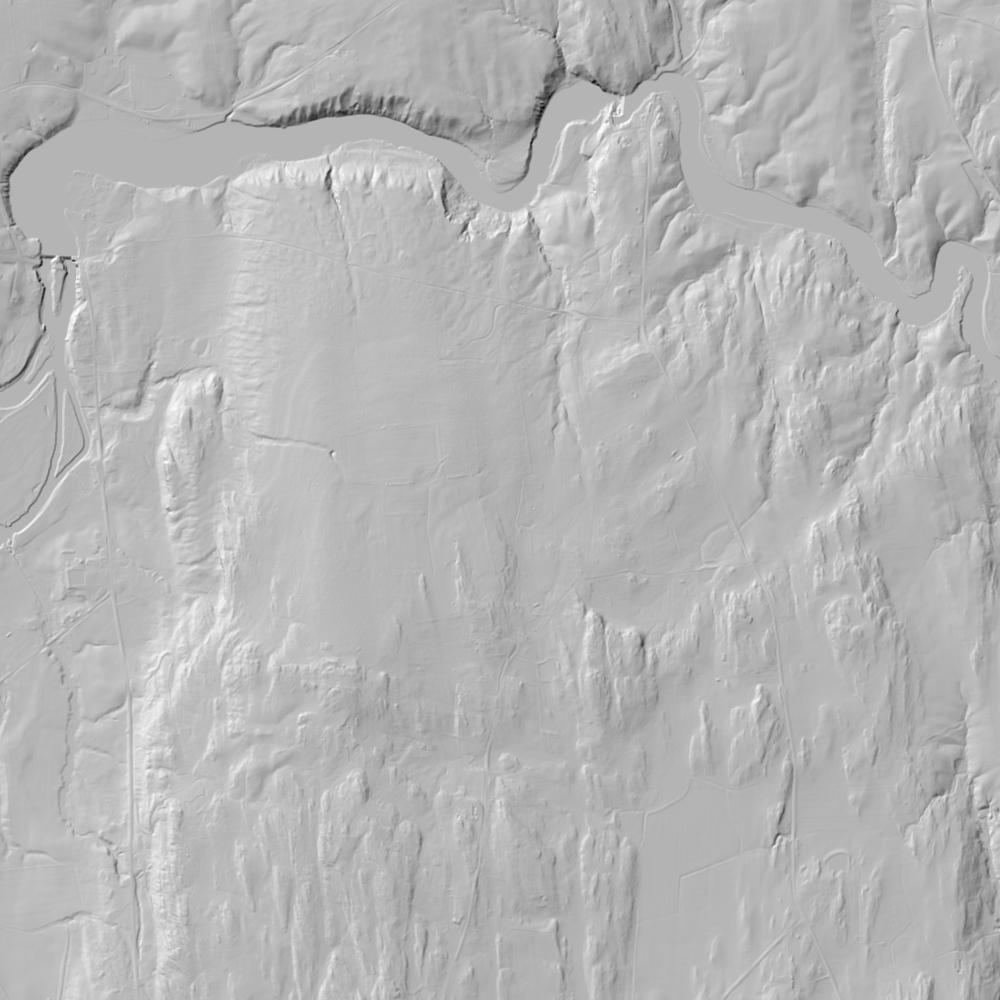
- Statewide Parcels, Stone-Wall Lidar & Court Files: VCGI publishes open statewide parcel polygons and 1-meter bare-earth lidar revealing 18th-century stone walls, while the 1823 U.S. Supreme Court transcript and UVM's Battell papers survive online.
What we are still confirming
- Whether the reserved Town School and Glebe Lease Lots adjoining the Weybridge/New Haven boundary still pay annual perpetual ground rent to the town school fund or have received modern statutory Fee-Simple Release Deeds from the Town Selectboard ([TO CONFIRM]: the governing statute).
Historical & landscape images
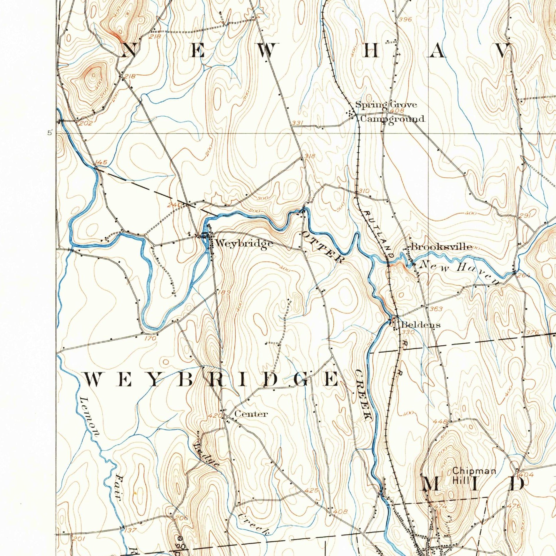
Aerial photographs, historical topographic surveys, lidar elevation, and ground imagery gathered for this place.
How to get more images
- USGS EarthExplorer (earthexplorer.usgs.gov, free account): Aerial Photo Single Frames, NHAP (1980–89, incl. color-infrared) and NAPP (1987–2007) covering this site. Medium-resolution scans download free; high-resolution film scans cost about $30 per frame (2–3 weeks).
- USDA FSA Aerial Photography Field Office (APFO, Salt Lake City): historic county-wide farm-program photos from the 1930s on, ordered by email/phone; scans run roughly $20–$50 per frame (check current price list).
- National Archives (College Park, Cartographic Branch): 1930s–1950s USDA/AAA aerials; free to view in person, reproductions through NARA's order service or approved vendors.
- the Vermont State Archives / state historical society and the state university map library (ask about historic aerial prints and scans); the state GIS clearinghouse for lidar.
- HistoricAerials.com (NETR Online): stitched historic aerials and topos by address; downloads/prints priced per image (often about $30–$80 for personal use; commercial licensing extra).
- Commercial satellite (Maxar/Vantor, Airbus, Planet via resellers such as SkyWatch or Apollo Mapping): archive scenes from ~$10–$25/km² with small minimum orders; new tasking costs more.
- Drone flight: a local FAA Part 107 pilot typically charges about $200–$600 for a basic photo/video shoot of a parcel; ask the landowner or site manager for permission first.
This sample report was researched from public records and checked against its sources. Historical research, not title or boundary advice.
← All 50 states, places & stories · Original 50 Picks Archive · Start your own Land File