50 States, 50 Places & 50 Stories › Oregon
Oregon sample place
Letitia Carson Soap Creek Claim (OSU Ranch)
Parcel at a glance
Letitia Carson's Soap Creek Claim sits in the foothills of the Coast Range north of Corvallis in Benton County, Township 10 South, Range 5 West, Sections 16, 17, and 20, Willamette Meridian. Owned today by Oregon State University as part of OSU's Soap Creek Beef Ranch and Dunn Forest, this public institutional sample joins Oregon's two live consenting private examples on YourLandHistory.org: Dan Whitaker's 3-parcel Marys River Place in Benton County (T12S, R5W, Sec. 10) and Dave Sullivan's 4-lot, 211-acre Pedee Tree Farm in Polk County (T9S, R6W, Secs. 28 and 33).
The land before the survey
For thousands of years before American settlement, the Soap Creek and Marys River watersheds were the homeland of the Chapanafa (Marys River) and Santiam bands of Kalapuyan-speaking people, whose regular autumn burning maintained open white oak savannas and camas prairies. Following the devastating malaria epidemics of 1831–1832, surviving bands signed the Willamette Valley Treaty at Dayton on January 22, 1855 (10 Stat. 1143) before removal to the Grand Ronde Reservation in 1856. Between 1851 and 1854, GLO deputy surveyors ran the Willamette Meridian township and claim lines across the valley.
First owners and the paper trail
In 1845, Letitia Carson—a Formerly Enslaved Black pioneer woman from Kentucky—and her Irish-born partner David Carson settled a 640-acre claim on Soap Creek, building a cabin, raising cattle, and planting an orchard. When David died without a will in 1852 and local officials excluded Letitia and their children from the Oregon Donation Land Act's married-couple provisions, Estate Administrator Greenberry Smith inventoried and sold off her property. Refusing to back down, Letitia Carson sued Smith in two Benton County lawsuits and won both jury verdicts: $300 plus costs in May 1855 for her labor, and $1,200 plus costs in October 1856 over cattle Smith had sold (she later received her own federal homestead patent in Douglas County on October 1, 1869, Patent ORRAA 008939). In 1941, the U.S. War Department condemned the Soap Creek valley farms for Camp Adair during World War II, later transferring the foothill pastures and timber to Oregon State University.
School-trust connection
Under Section 4 of the Oregon Admission Act of February 14, 1859 (11 Stat. 383), Congress granted Sections 16 and 36 of every township to the State of Oregon as a trust for public schools, promising equivalent "indemnity lieu land" wherever an early settler's claim preempted a school section. Both Benton County examples show that collision firsthand: David and Letitia Carson's initial 1845 640-acre claim extended into Section 16 of T10S, R5W before being reduced in the 1850s estate adjustment, just as George and Kezia Bethers' Donation Land Claim No. 49 next to the Whitaker Place ran directly into Section 16 of T12S, R5W.
What records survive and where to look
- 180 Lawsuit Papers & OSU Archives: Roughly 180 original 1852–1856 Benton County probate and lawsuit papers discovered by Dr. Bob Zybach (ORWW / NW Maps Co.) are preserved at the Benton County Courthouse, the Oregon State Archives, and the online Zybach/Meranda archive, alongside 1941 Camp Adair files and 2022 OSU archaeology reports. Dr. Zybach's archival recovery established that Carson's lawsuits secured compensation for her labor ($300) and cattle ($1,200), while her later land patent was secured in Douglas County (ORRAA 008939).
- Full Live v2.0 Oregon Stack: Statewide 1850s GLO survey plats and field notes, BLM patents, Benton and Polk County Assessor and Surveyor files (such as Partition MLP 47), DOGAMI lidar, and OWRD water rights (such as Certificates #17385 and #40289 on the Pedee farm) are live on the platform.
What we are still confirming
- The exact 1852–1854 boundary line where David Carson's initial 640-acre Soap Creek claim was trimmed from Section 16 into Section 17 of T10S, R5W, and the exact 1941 War Department Camp Adair condemnation tract numbers transferring the parcels to OSU.
Historical & landscape images
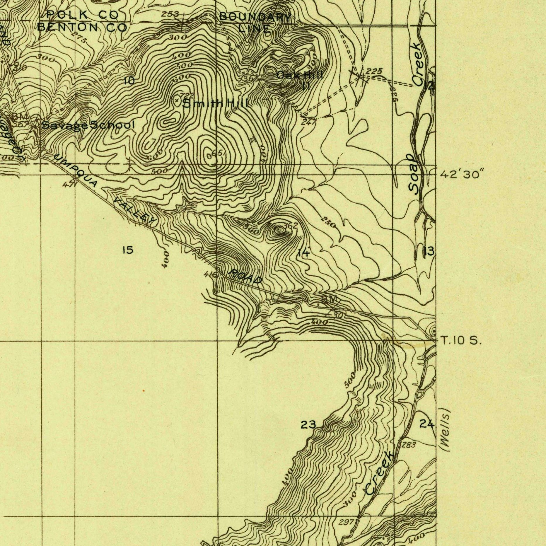
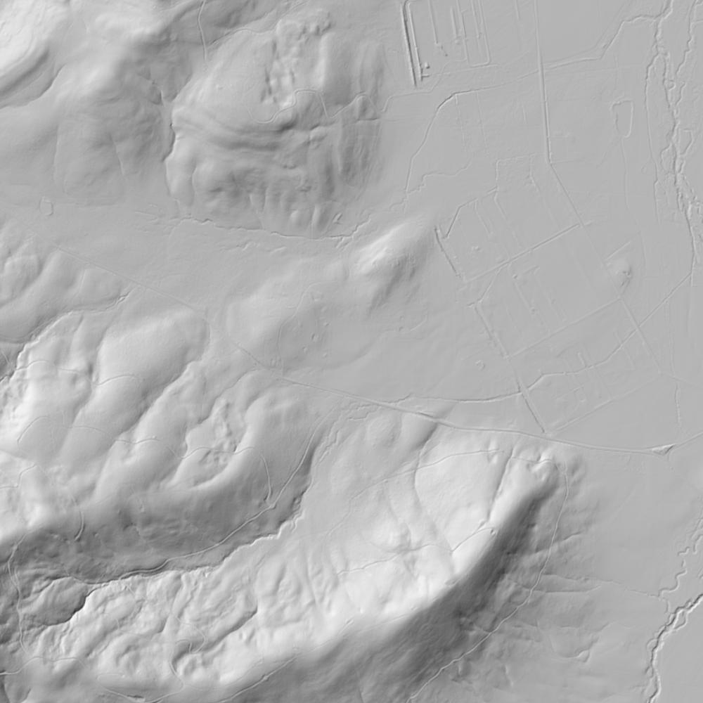
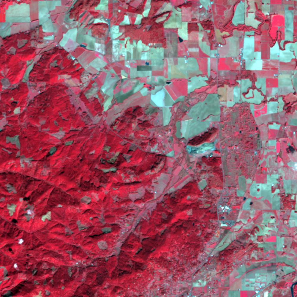
Aerial photographs, historical topographic surveys, lidar elevation, and ground imagery gathered for this place.
How to get more images
- USGS EarthExplorer (earthexplorer.usgs.gov, free account): Aerial Photo Single Frames, NHAP (1980–89, incl. color-infrared) and NAPP (1987–2007) covering this site. Medium-resolution scans download free; high-resolution film scans cost about $30 per frame (2–3 weeks).
- USDA FSA Aerial Photography Field Office (APFO, Salt Lake City): historic county-wide farm-program photos from the 1930s on, ordered by email/phone; scans run roughly $20–$50 per frame (check current price list).
- National Archives (College Park, Cartographic Branch): 1930s–1950s USDA/AAA aerials; free to view in person, reproductions through NARA's order service or approved vendors.
- Oregon State Archives and the UO Map & Aerial Photography Library (historic aerial prints/scans by request); Oregon DOGAMI Lidar Viewer for free statewide lidar.
- HistoricAerials.com (NETR Online): stitched historic aerials and topos by address; downloads/prints priced per image (often about $30–$80 for personal use; commercial licensing extra).
- Commercial satellite (Maxar/Vantor, Airbus, Planet via resellers such as SkyWatch or Apollo Mapping): archive scenes from ~$10–$25/km² with small minimum orders; new tasking costs more.
- Drone flight: a local FAA Part 107 pilot typically charges about $200–$600 for a basic photo/video shoot of a parcel; ask the landowner or site manager for permission first.
This sample report was researched from public records and checked against its sources. Historical research, not title or boundary advice.
← All 50 states, places & stories · Original 50 Picks Archive · Start your own Land File