50 States, 50 Places & 50 Stories › North Dakota
North Dakota sample place
Chateau de Mores State Historic Site & Bakken School Section 16
Parcel at a glance
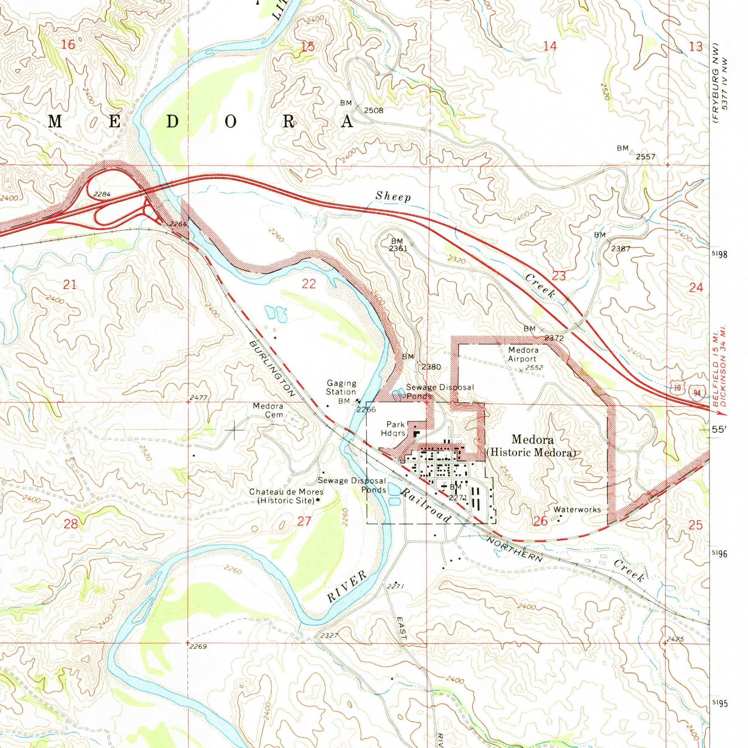
The Chateau de Mores State Historic Site and its adjoining Little Missouri Badlands sections sit just west of Medora in Billings County, Township 140 North, Range 102 West, Sections 16, 21, and 22, Fifth Principal Meridian. Owned by the State of North Dakota (managed by the State Historical Society of North Dakota) and abutting an active state school-trust section, this property pairs an 1883 Northern Pacific Railroad cattle-and-meatpacking venture with North Dakota's constitutional retention of subsurface school-section oil and gas minerals.
The land before the survey
For centuries, the sheltered cottonwood bottoms and rugged clay buttes of the Little Missouri River Badlands were winter camp sites, eagle-trapping grounds, and bison hunting territories of the Mandan, Hidatsa, and Arikara Nation (Three Affiliated Tribes), the Lakota and Dakota (Oceti Sakowin), and the Apsáalooke (Crow) Nation. In 1864, Congress chartered the Northern Pacific Railroad, granting the company a checkerboard of odd-numbered sections reaching up to 40 miles on each side of its track across the territories. Federal deputy surveyors extended the Fifth Principal Meridian grid across the Little Missouri River crossing in the late 1870s and early 1880s as the railroad tracks arrived.
First owners and the paper trail
In April 1883, French nobleman Antoine de Vallombrosa, the Marquis de Mores, arrived at the Little Missouri rail crossing, founded the town of Medora (named for his wife, Medora von Hoffman), and purchased odd-numbered railroad land in Sections 21 and 22 from the Northern Pacific Railroad. Attempting to bypass Chicago meatpackers by slaughtering range cattle right on the plains and shipping chilled beef east in refrigerated railcars, de Mores built a 26-room hillside chateau, a giant brick abattoir (packing plant), and icehouses along the river. After harsh winters and market resistance closed the packing plant in 1886, surrounding even-numbered sections were proved up under the 1862 Homestead and 1909 Enlarged (320-acre) Homestead Acts before the de Mores family donated the chateau and packing-plant site to the State of North Dakota in 1936.
School-trust connection
Under the Omnibus Enabling Act of February 22, 1889 (25 Stat. 676), Congress granted North Dakota Sections 16 and 36 of every township for public schools with a strict $10-per-acre minimum sale floor. Even more consequential for modern landowners, under Article IX of the North Dakota Constitution and state statutes, whenever the North Dakota Department of Trust Lands sold the surface of a school section, the reservation depended on the sale date: nothing before 1939, 5% under the 1939 law, 50% from February 20, 1941, and all minerals (including coal) under the 1960 constitutional amendment. On unsold school sections like adjoining Section 16, T140N, R102W, the state holds the full mineral estate for the Common Schools Trust Fund ([TO CONFIRM]: current oil and gas production on this section).
What records survive and where to look
- State Trust Mineral & Oil/Gas GIS: The North Dakota Department of Trust Lands publishes an open GIS viewer mapping all state-owned surface and reserved mineral school sections, while the ND Department of Mineral Resources and State Water Commission host free online oil, gas, and water well logs.
- Historical Society, GLO & County Deeds: The State Historical Society of North Dakota holds the de Mores business papers and historic photographs; 1880s survey notes and patents are on the BLM GLO portal; and Billings and parent Stark County deeds back to 1883 are on FamilySearch.
What we are still confirming
- The exact 1883 Northern Pacific Railroad out-sale deed book, page, and mineral-reservation clause in the Billings County Recorder's vault for the de Mores parcels in Sections 21 and 22, and the current oil and gas lease numbers on adjoining Section 16.
Historical & landscape images
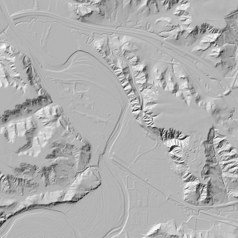
Aerial photographs, historical topographic surveys, lidar elevation, and ground imagery gathered for this place.

How to get more images
- USGS EarthExplorer (earthexplorer.usgs.gov, free account): Aerial Photo Single Frames, NHAP (1980–89, incl. color-infrared) and NAPP (1987–2007) covering this site. Medium-resolution scans download free; high-resolution film scans cost about $30 per frame (2–3 weeks).
- USDA FSA Aerial Photography Field Office (APFO, Salt Lake City): historic county-wide farm-program photos from the 1930s on, ordered by email/phone; scans run roughly $20–$50 per frame (check current price list).
- National Archives (College Park, Cartographic Branch): 1930s–1950s USDA/AAA aerials; free to view in person, reproductions through NARA's order service or approved vendors.
- the North Dakota State Archives / state historical society and the state university map library (ask about historic aerial prints and scans); the state GIS clearinghouse for lidar.
- HistoricAerials.com (NETR Online): stitched historic aerials and topos by address; downloads/prints priced per image (often about $30–$80 for personal use; commercial licensing extra).
- Commercial satellite (Maxar/Vantor, Airbus, Planet via resellers such as SkyWatch or Apollo Mapping): archive scenes from ~$10–$25/km² with small minimum orders; new tasking costs more.
- Drone flight: a local FAA Part 107 pilot typically charges about $200–$600 for a basic photo/video shoot of a parcel; ask the landowner or site manager for permission first.
This sample report was researched from public records and checked against its sources. Historical research, not title or boundary advice.
← All 50 states, places & stories · Original 50 Picks Archive · Start your own Land File