50 States, 50 Places & 50 Stories › New Jersey
New Jersey sample place
Howell Living History Farm & Riparian School-Fund Creek Edge
Parcel at a glance
The Howell Living History Farm sits in the Pleasant Valley along Moore's Creek just north of Titusville in Mercer County (formerly Hunterdon County, Hopewell Township), inside an early 1700s Council of Proprietors of West New Jersey Survey. Owned today by Mercer County as a 130-acre working public historical farm, the property illustrates New Jersey's private corporate proprietary land system and its constitutional Riparian Tidelands School Fund compact.
The land before the survey
For thousands of years before European colonization, the Delaware River Valley and the diabase ridges of the Sourland and Baldpate Mountains were the homeland of the Unami-speaking Lenape people. As an original thirteen-colony state, New Jersey has no federal rectangular survey grid. Divided in 1676 into East Jersey and West Jersey, the underlying fee title to all unpatented land belonged not to the Crown or the state, but to two private corporations—the Board of Proprietors of East Jersey and the Council of Proprietors of West New Jersey (organized in 1688 at Burlington)—which issued private metes-and-bounds warrants and surveys well into the late 20th century.
First owners and the paper trail
Beginning around 1700, shareholders holding fractional "Proprieties" in West Jersey obtained warrants from the Council of Proprietors to survey irregular farm tracts along Moore's Creek in Hopewell Township, marking corner white oaks, black oaks, and stone heaps. Across the 18th and 19th centuries, successive families ([TO CONFIRM]: names of 18th–19th-century owners) built stone houses, a gristmill and mill race, and timber-frame barns, transferring the farm through recorded deeds and Hunterdon and Mercer County Orphans' Court estate partitions until Inez Howell donated the farm to Mercer County in memory of her husband, Charles Howell, in 1974 ([TO CONFIRM]: donation details).
School-trust connection
Because the private East and West Jersey Proprietors owned the colony's ungranted dry uplands, New Jersey had no public domain to put into a standard Section 16 school trust. Instead, after establishing the Fund for the Support of Free Schools in 1817, the legislature in 1871 and 1894 constitutionally dedicated 100% of New Jersey's sovereign Riparian Tidelands—all lands now or formerly flowed by the mean high tide of the ocean, bays, and tidal rivers and creeks—to the Permanent School Fund. To this day, whenever a New Jersey parcel crosses a mapped historical tidal creek, the landowner must purchase a Riparian Grant or Lease from the state Tidelands Resource Council, with every dollar supporting public school bonds.
What records survive and where to look
- Proprietary Warrants & County Deeds: The New Jersey State Archives Early Land Records Database provides online abstracts and scans of West Jersey Proprietary Warrants, Surveys, and Colonial Deeds (1664–1785), while Hunterdon (from 1714) and Mercer (from 1838) County deeds are digitized on FamilySearch.
- Tidelands Claim Maps, 1930 Aerials & Lidar: NJDEP's NJ-GeoWeb portal publishes open statewide tax parcels, 1-meter lidar, 1930 statewide aerial photography, and the official State School Fund Riparian Tidelands Claim Overlay maps.
What we are still confirming
- The exact West Jersey Surveyor General Book and Page citation in the Burlington proprietary archives for the initial 1700s survey return covering the Moore's Creek mill and farmstead tract.
Historical & landscape images
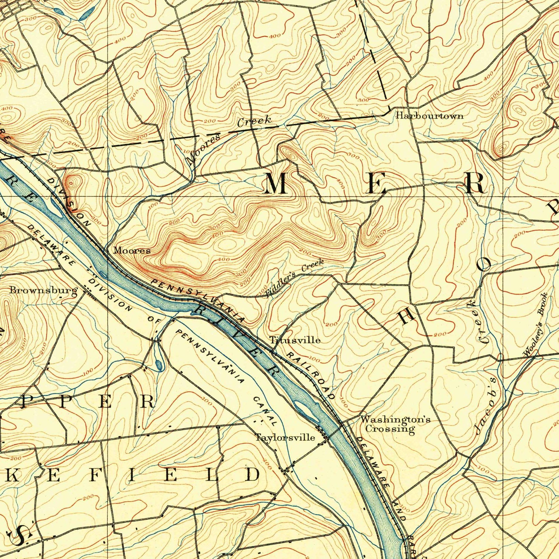
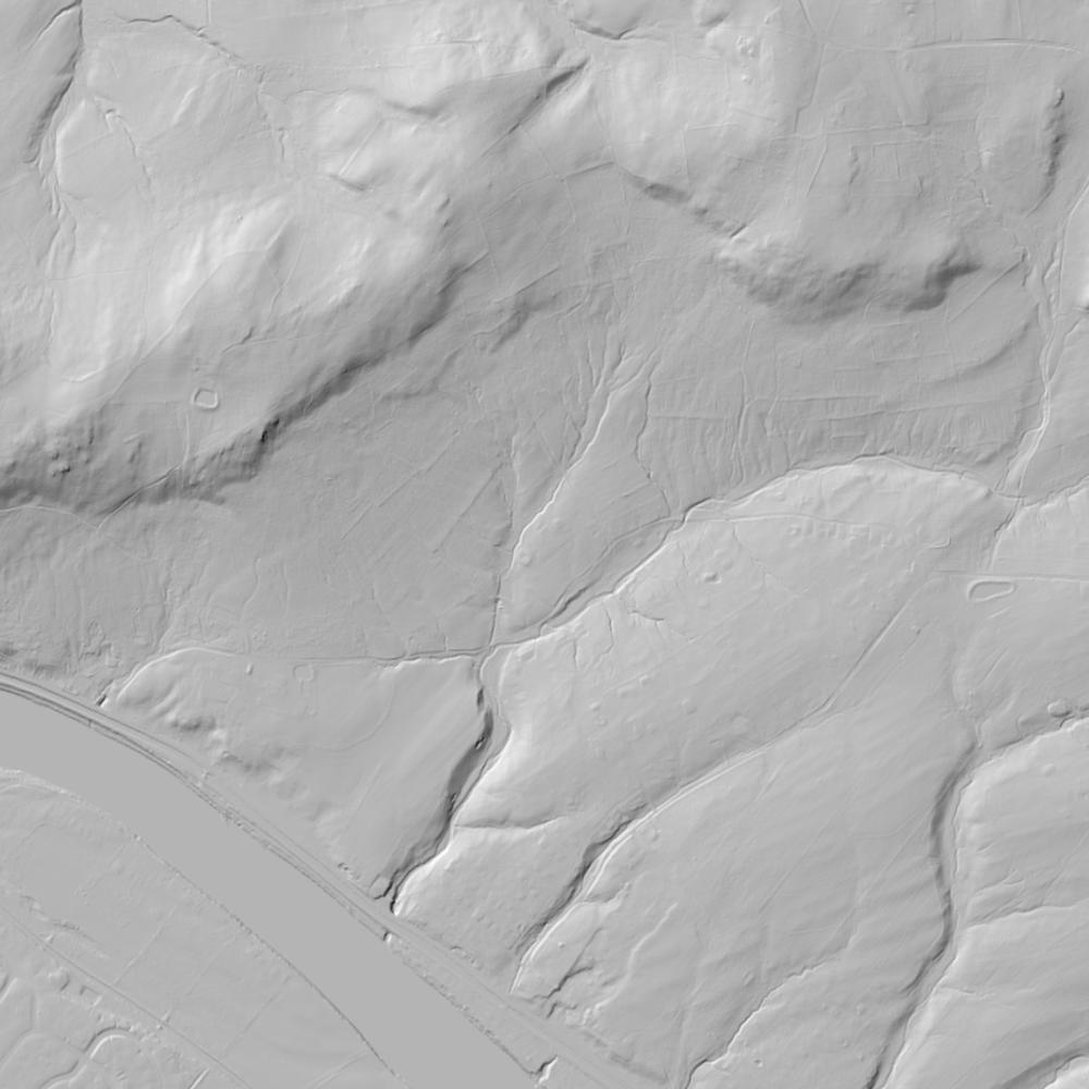
Aerial photographs, historical topographic surveys, lidar elevation, and ground imagery gathered for this place.

How to get more images
- USGS EarthExplorer (earthexplorer.usgs.gov, free account): Aerial Photo Single Frames, NHAP (1980–89, incl. color-infrared) and NAPP (1987–2007) covering this site. Medium-resolution scans download free; high-resolution film scans cost about $30 per frame (2–3 weeks).
- USDA FSA Aerial Photography Field Office (APFO, Salt Lake City): historic county-wide farm-program photos from the 1930s on, ordered by email/phone; scans run roughly $20–$50 per frame (check current price list).
- National Archives (College Park, Cartographic Branch): 1930s–1950s USDA/AAA aerials; free to view in person, reproductions through NARA's order service or approved vendors.
- NJGIN 1930 statewide aerials (free) and NJ State Archives.
- HistoricAerials.com (NETR Online): stitched historic aerials and topos by address; downloads/prints priced per image (often about $30–$80 for personal use; commercial licensing extra).
- Commercial satellite (Maxar/Vantor, Airbus, Planet via resellers such as SkyWatch or Apollo Mapping): archive scenes from ~$10–$25/km² with small minimum orders; new tasking costs more.
- Drone flight: a local FAA Part 107 pilot typically charges about $200–$600 for a basic photo/video shoot of a parcel; ask the landowner or site manager for permission first.
This sample report was researched from public records and checked against its sources. Historical research, not title or boundary advice.
← All 50 states, places & stories · Original 50 Picks Archive · Start your own Land File