50 States, 50 Places & 50 Stories › Minnesota
Minnesota sample place
Boundary Waters School Trust Section 16 (with Hill Annex Sidebar)
Parcel at a glance
The Boundary Waters School Trust Section 16 parcel sits in the lakes-and-granite backcountry of Lake County, Township 64 North, Range 6 West, Section 16, Fourth Principal Meridian, covering 640 acres around Ledge, Bewon, Siren, Darlet, and Vee Lakes. Owned by the State of Minnesota as Permanent School Fund trust land inside the federal Boundary Waters Canoe Area Wilderness (BWCAW)—and paired with the state's Hill Annex Iron Mine school section in Itasca County (T56N, R23W, Sec. 16)—this parcel traces a northern school section from 1858 statehood to a pending 2028 federal buyout.
The land before the survey
For centuries, this boreal wilderness of glacially scoured granite ridges, canoe portages, and red and white pine forests was the homeland of the Bois Forte and Grand Portage bands of Lake Superior Ojibwe (Anishinaabe). Following the Treaty of La Pointe of September 30, 1854 (10 Stat. 1109), federal deputy surveyors extended the Fourth Principal Meridian across the Arrowhead region in the late 19th century, running section lines across frozen lakes and spruce-fir bogs.
First owners and the paper trail
Unlike neighboring sections patented through timber entries, homesteads, or scrip, title to Section 16 vested directly in the State of Minnesota upon survey approval under the Minnesota Enabling Act of February 26, 1857 (11 Stat. 166) and 1858 statehood. Across northern Minnesota, while private timber and mining tracts frequently used Minnesota's Torrens (Registered Land) system (which records all active easements and mineral severances on a single Certificate of Title), state school sections on the Mesabi Iron Range—such as Section 16 in T56N, R23W (the Hill Annex Mine), which operated as an open-pit iron mine from 1913 to 1978, later became a state park, which the Legislature deauthorized and closed in 2024 so iron mining could resume—generate lease and royalty income for the Permanent School Fund ([TO CONFIRM]: cumulative royalty total).
School-trust connection
In 1978, Congress passed the Boundary Waters Canoe Area Wilderness Act (Pub. L. 95-495), enclosing roughly 80,000 acres of state-owned school trust land (including Section 16, T64N, R6W) inside a federal wilderness where commercial logging and mining are barred. Under the Minnesota Constitution (Art. XI, Sec. 8, which establishes the Permanent School Fund) and state statute (Minn. Stat. § 127A.31), school trust lands are to be managed to secure the maximum long-term economic return for public schools, while the U.S. Forest Service is mandated by federal statute to preserve the wilderness character of the BWCAW. After a proposed land exchange was withdrawn and its environmental review canceled in July 2024, the Minnesota DNR began a condemnation of about 80,000 acres of school trust land inside the BWCAW, which removes the school-trust designation, followed by a direct sale to the U.S. Forest Service funded through Land and Water Conservation Fund appropriations; proceeds go to the Permanent School Fund, and the sale is expected to close in 2028 (Minnesota DNR, BWCAW School Trust Land Condemnation FAQ).
What records survive and where to look
- State Trust & Exchange Files: Minnesota DNR and Office of School Trust Lands project files, Permanent School Fund Commission memos, the U.S. Forest Service exchange and appraisal records, and the June 2024 Hill Annex state park closure notices are available online.
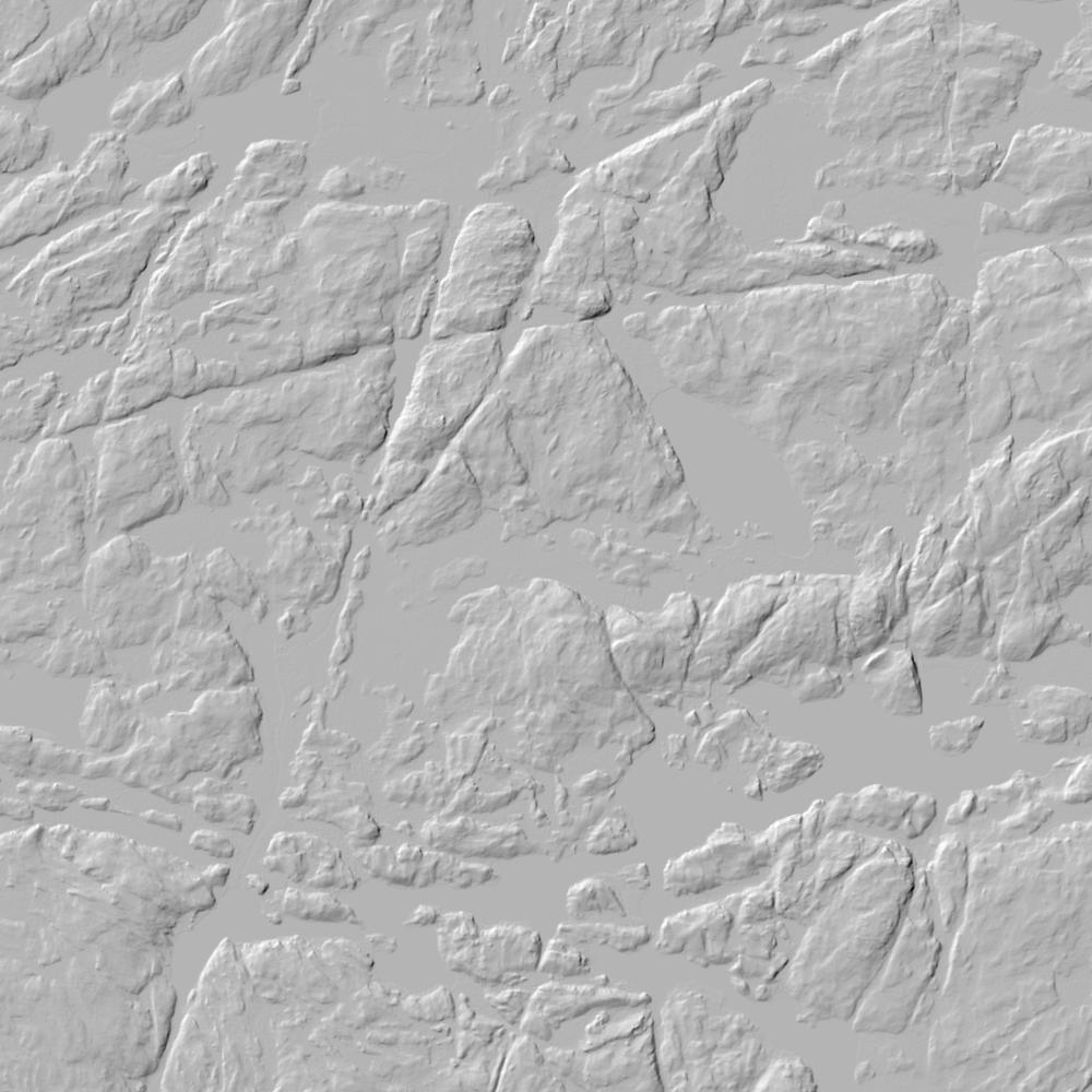
- Survey Plats, Lidar & County GIS: Original GLO survey plats and field notes are on the BLM GLO portal, while MnTOPO 1-meter lidar and Lake and Itasca County GIS portals provide parcel attributes and corner certificates.
What we are still confirming
- The final court-approved condemnation award figure and per-acre appraisal valuation for Section 16, T64N, R6W in the pending Forest Service purchase.
Historical & landscape images
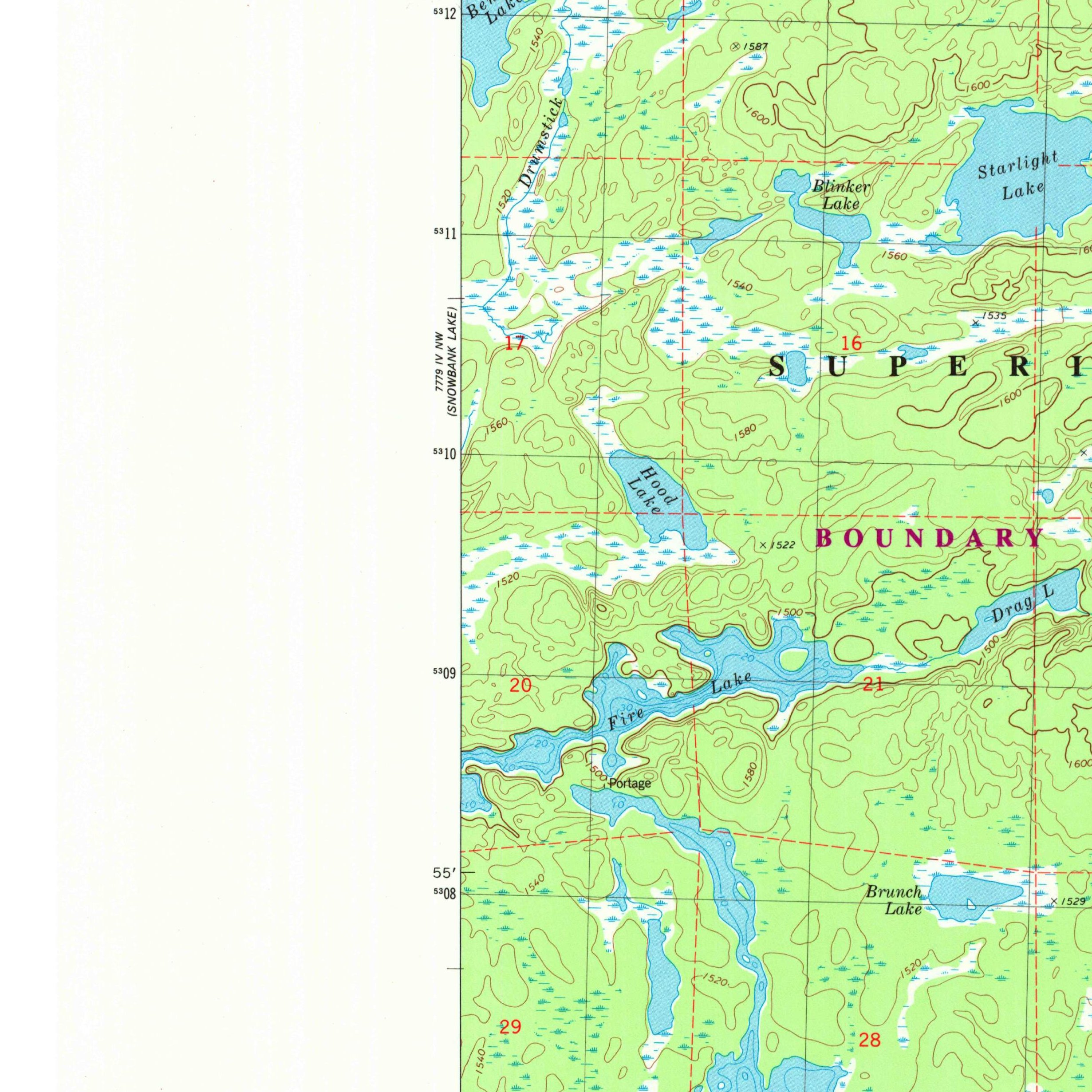
Aerial photographs, historical topographic surveys, lidar elevation, and ground imagery gathered for this place.
How to get more images
- USGS EarthExplorer (earthexplorer.usgs.gov, free account): Aerial Photo Single Frames, NHAP (1980–89, incl. color-infrared) and NAPP (1987–2007) covering this site. Medium-resolution scans download free; high-resolution film scans cost about $30 per frame (2–3 weeks).
- USDA FSA Aerial Photography Field Office (APFO, Salt Lake City): historic county-wide farm-program photos from the 1930s on, ordered by email/phone; scans run roughly $20–$50 per frame (check current price list).
- National Archives (College Park, Cartographic Branch): 1930s–1950s USDA/AAA aerials; free to view in person, reproductions through NARA's order service or approved vendors.
- University of Minnesota Borchert Map Library (MHAPO historic aerials, many free online).
- HistoricAerials.com (NETR Online): stitched historic aerials and topos by address; downloads/prints priced per image (often about $30–$80 for personal use; commercial licensing extra).
- Commercial satellite (Maxar/Vantor, Airbus, Planet via resellers such as SkyWatch or Apollo Mapping): archive scenes from ~$10–$25/km² with small minimum orders; new tasking costs more.
- Drone flight: a local FAA Part 107 pilot typically charges about $200–$600 for a basic photo/video shoot of a parcel; ask the landowner or site manager for permission first.
This sample report was researched from public records and checked against its sources. Historical research, not title or boundary advice.
← All 50 states, places & stories · Original 50 Picks Archive · Start your own Land File