50 States, 50 Places & 50 Stories › Michigan
Michigan sample place
U-M Saginaw Forest & Stinchfield Woods (1837 School Fund Edge)
Parcel at a glance
The University of Michigan's Saginaw Forest sits on the rolling glacial moraine hills around Third Sister Lake just west of Ann Arbor in Washtenaw County, Township 2 South, Range 5 East (Scio Township), Section 26 (paired with nearby Section 16), Michigan Meridian. Owned by the University of Michigan since 1903 as an 80-acre experimental forest and freshwater research reserve, this parcel links the 1825 Erie Canal settlement boom with the birth of America's first centralized statewide school trust fund.
The land before the survey
For centuries before American settlement, the Huron River watershed was the homeland of the Anishinaabeg—the Bodewadmi (Potawatomi), Ojibwe, and Odawa peoples of the Three Fires Confederacy—whose regular seasonal burning maintained park-like "Oak Openings" (open white and bur oak savannas) across the glacial hills and kettle lakes. Following the 1807 Treaty of Detroit (7 Stat. 105) and Surveyor General Edward Tiffin's infamous 1815 report claiming Michigan Territory was an uninhabitable swamp, Deputy surveyors subdivided Township 2 South, Range 5 East around 1819 ([TO CONFIRM]: surveyor name and year) on the Michigan Meridian, recording rich oak openings, hickory ridges, and spring-fed lakes.
First owners and the paper trail
The 1825 opening of the Erie Canal brought a wave of New York and New England farm families into Washtenaw County. Settlers purchased the quarter-sections of Section 26 at the Detroit Land Office under the Cash Entry Act of 1820 ($1.25 per acre) and cleared the oak ridges for wheat fields and sheep pastures. After decades of hillside plowing caused soil erosion into Third Sister Lake, Saginaw lumberman and University Regent Arthur Hill purchased the 80-acre farm in 1903 and deeded it to the University of Michigan as a forestry demonstration tract, where students and faculty planted white pine, red oak, and black walnut stands documented plot by plot for over 120 years.
School-trust connection
Michigan's Admission Act of June 23, 1836 / January 26, 1837 (5 Stat. 59) permanently reshaped American school-trust law. In every state admitted before 1837, Congress had granted Section 16 to the inhabitants of each individual township, resulting in fragmented local management. At the urging of Michigan education leaders Isaac Crary and John D. Pierce, Congress granted all Section 16s directly to the State of Michigan as a unified, statewide Primary School Fund—setting the constitutional standard for every Western state admitted afterward and governing the sale of Section 16 of T2S, R5E near Saginaw Forest ([TO CONFIRM]: distance).
What records survive and where to look
- County GIS & Corner Records: Washtenaw County's MapWashtenaw GIS publishes open parcel polygons and direct PDF links to County Surveyor Land Corner Recordation Certificates (LCRCs) tying modern steel monuments back to the original 1819 bearing trees.
- Federal Patents, Forestry Maps & Deeds: 1819 GLO survey notes and cash patents are on the BLM GLO portal; the U-M Bentley Historical Library holds the 1903 Arthur Hill deed and historical planting maps; and Washtenaw County deeds back to 1824 are digitized on FamilySearch.
What we are still confirming
- The exact State Land Office Primary School Patent number and 1840s–1850s purchaser names in the Archives of Michigan for neighboring Section 16, T2S, R5E.
Historical & landscape images
Aerial photographs, historical topographic surveys, lidar elevation, and ground imagery gathered for this place.
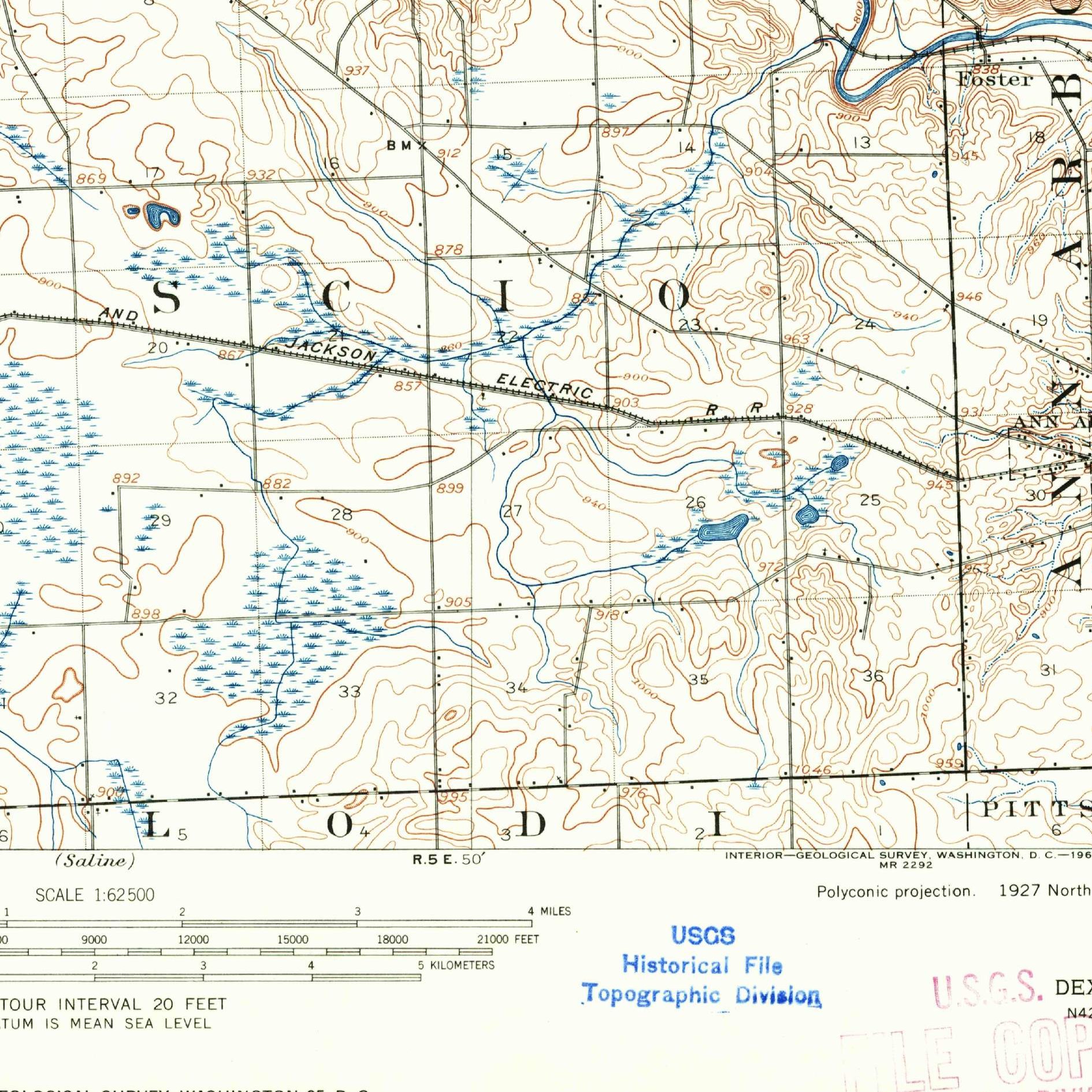
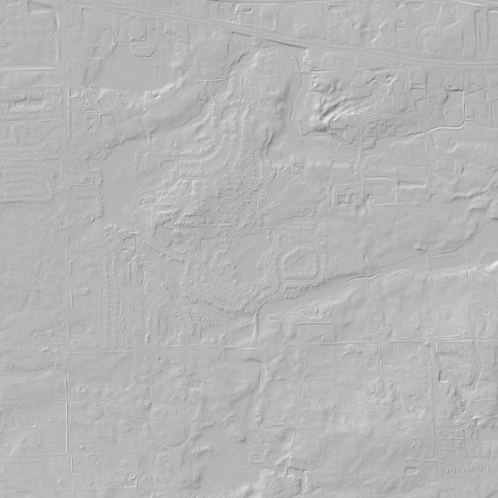

How to get more images
- USGS EarthExplorer (earthexplorer.usgs.gov, free account): Aerial Photo Single Frames, NHAP (1980–89, incl. color-infrared) and NAPP (1987–2007) covering this site. Medium-resolution scans download free; high-resolution film scans cost about $30 per frame (2–3 weeks).
- USDA FSA Aerial Photography Field Office (APFO, Salt Lake City): historic county-wide farm-program photos from the 1930s on, ordered by email/phone; scans run roughly $20–$50 per frame (check current price list).
- National Archives (College Park, Cartographic Branch): 1930s–1950s USDA/AAA aerials; free to view in person, reproductions through NARA's order service or approved vendors.
- the Michigan State Archives / state historical society and the state university map library (ask about historic aerial prints and scans); the state GIS clearinghouse for lidar.
- HistoricAerials.com (NETR Online): stitched historic aerials and topos by address; downloads/prints priced per image (often about $30–$80 for personal use; commercial licensing extra).
- Commercial satellite (Maxar/Vantor, Airbus, Planet via resellers such as SkyWatch or Apollo Mapping): archive scenes from ~$10–$25/km² with small minimum orders; new tasking costs more.
- Drone flight: a local FAA Part 107 pilot typically charges about $200–$600 for a basic photo/video shoot of a parcel; ask the landowner or site manager for permission first.
This sample report was researched from public records and checked against its sources. Historical research, not title or boundary advice.
← All 50 states, places & stories · Original 50 Picks Archive · Start your own Land File