50 States, 50 Places & 50 Stories › Maine
Maine sample place
Great Pond Mountain Wildlands & Orland Public Lot Edge
Parcel at a glance
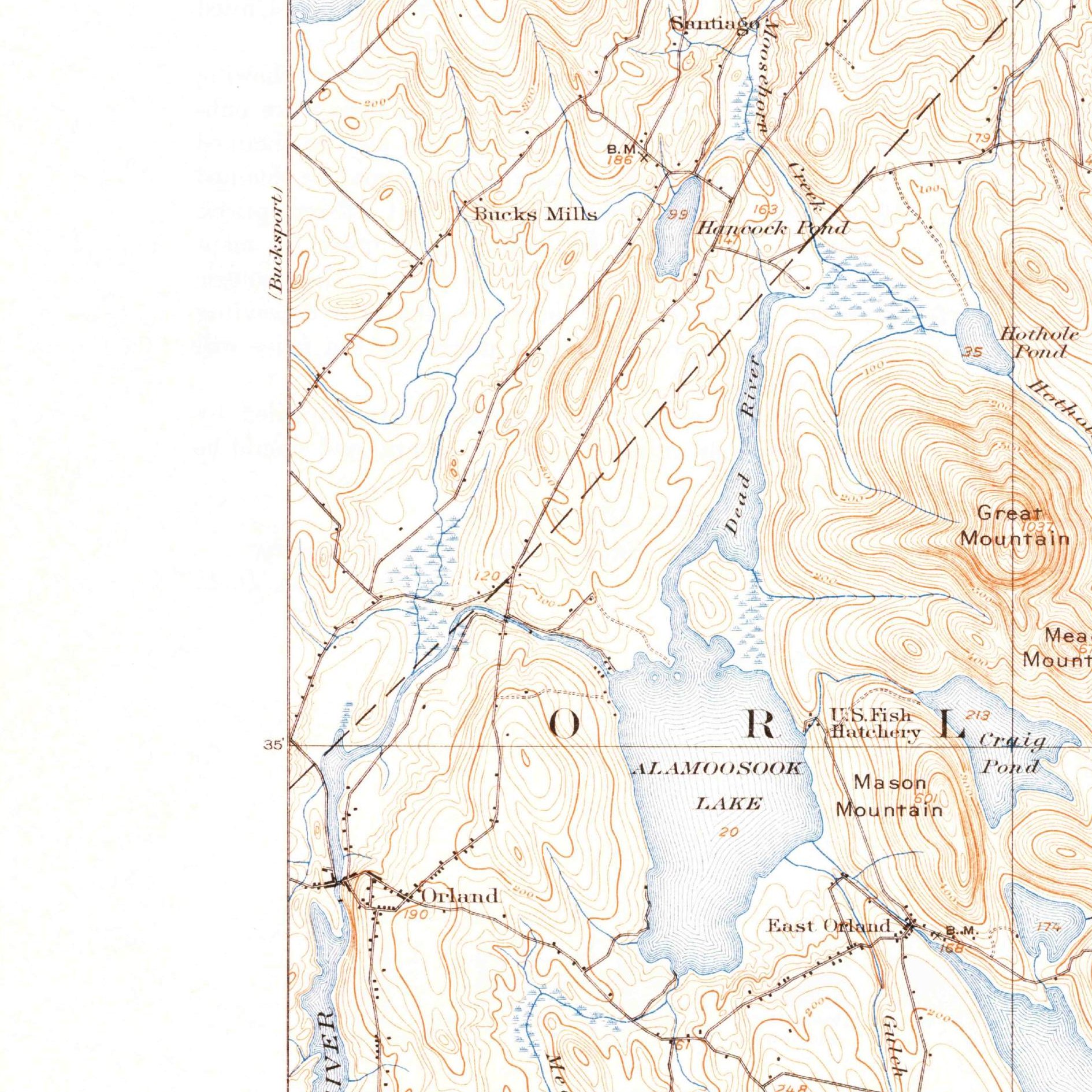
The Great Pond Mountain Wildlands and Orland Public Lot Edge sit across the granite ridges of Great Pond Mountain, Hothole Valley, and Dead River just east of the Penobscot River in Hancock County (Town of Orland), inside historic Massachusetts Eastern River Township No. 2. Owned and managed for public recreation and working forestry by the nonprofit Great Pond Mountain Conservation Trust, this 4,500-acre woodland property shows how Massachusetts surveyed and endowed the District of Maine.
The land before the survey
For thousands of years, the Penobscot River estuary, Toddy Pond, and the Alamoosook Lake canoe portages were the homeland of the Penobscot Nation and the wider Wabanaki Confederacy, whose river salmon and alewife fisheries sustained villages across the watershed. Because Maine was governed as the "District of Maine" by the Commonwealth of Massachusetts until 1820 statehood, it has no federal PLSS grid. Instead, after Governor Thomas Pownall built Fort Pownall at the mouth of the Penobscot in 1759, Massachusetts granted six townships east of the Penobscot River in 1762 and later surveyed neighboring interior townships for the 1786 Massachusetts Land Lottery, laid out by surveyors including Rufus Putnam to help pay Revolutionary War debt.
First owners and the paper trail
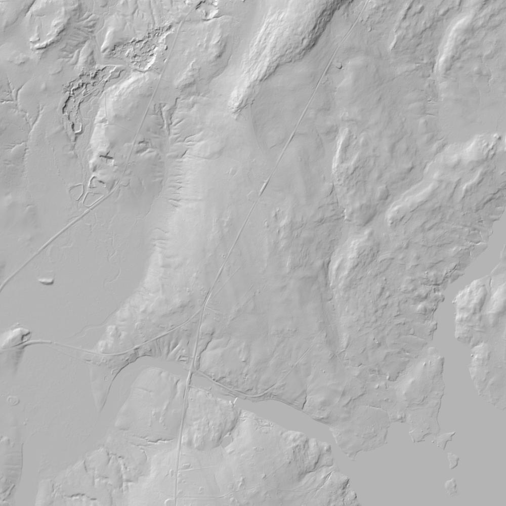
Under the 1762/1765 Proprietors' grant of Township No. 2 (incorporated as the Town of Orland in 1800), town proprietors surveyed riverfront and upland divisions measured in rods and links while damming the Narramissic (Orland) River for sawmills and gristmills. Across the 19th and 20th centuries, the Hothole Valley and mountain lots supplied white pine, spruce, and hardwood cordwood for coastal shipyards, brickyards, and the Bucksport paper mill—leaving behind miles of colonial stone walls, stone cellar holes, and old logging roads that stand out vividly today on 1-meter bare-earth lidar before the conservation trust purchased the 4,500-acre property in 2005 from a commercial timber company.
School-trust connection
In every Eastern Lands township charter and lottery township in Maine, the Commonwealth of Massachusetts required proprietors to reserve four 300- to 320-acre "Public Lots"—one for the First Settled Minister, one for the Ministry, one for the State/Harvard, and one in perpetuity for Town Grammar Schools. Upon Maine's 1820 statehood under the Articles of Separation, those Public Reserved Lots became the foundation of Maine's public-school and public-reserved-lands trust.
What records survive and where to look
- Online County Registry & Proprietor Plans: Unlike southern New England states that record by town, Maine records deeds by county—and the Hancock County Registry of Deeds (maineregistries.com) provides free online scans of Grantor-Grantee indexes, early deed books, and original Proprietors' Lot Plan maps back to 1790 (with pre-1790 parent Lincoln County deeds on FamilySearch).
- Lidar & Mass. Archives: Maine GeoLibrary hosts open statewide parcel GIS and 1-meter lidar, while the Massachusetts Archives Eastern Lands Papers are digitized on FamilySearch.
What we are still confirming
- The exact Proprietors' Lot numbers on the 18th-century Orland division plan for the reserved 300-acre Town School and Ministerial lots relative to the Hothole Valley boundary.
Historical & landscape images
Aerial photographs, historical topographic surveys, lidar elevation, and ground imagery gathered for this place.
How to get more images
- USGS EarthExplorer (earthexplorer.usgs.gov, free account): Aerial Photo Single Frames, NHAP (1980–89, incl. color-infrared) and NAPP (1987–2007) covering this site. Medium-resolution scans download free; high-resolution film scans cost about $30 per frame (2–3 weeks).
- USDA FSA Aerial Photography Field Office (APFO, Salt Lake City): historic county-wide farm-program photos from the 1930s on, ordered by email/phone; scans run roughly $20–$50 per frame (check current price list).
- National Archives (College Park, Cartographic Branch): 1930s–1950s USDA/AAA aerials; free to view in person, reproductions through NARA's order service or approved vendors.
- the Maine State Archives / state historical society and the state university map library (ask about historic aerial prints and scans); the state GIS clearinghouse for lidar.
- HistoricAerials.com (NETR Online): stitched historic aerials and topos by address; downloads/prints priced per image (often about $30–$80 for personal use; commercial licensing extra).
- Commercial satellite (Maxar/Vantor, Airbus, Planet via resellers such as SkyWatch or Apollo Mapping): archive scenes from ~$10–$25/km² with small minimum orders; new tasking costs more.
- Drone flight: a local FAA Part 107 pilot typically charges about $200–$600 for a basic photo/video shoot of a parcel; ask the landowner or site manager for permission first.
This sample report was researched from public records and checked against its sources. Historical research, not title or boundary advice.
← All 50 states, places & stories · Original 50 Picks Archive · Start your own Land File