50 States, 50 Places & 50 Stories › Idaho
Idaho sample place
Payette Lake School Endowment Section 16
Parcel at a glance
The Payette Lake School Endowment Block sits at McCall in Valley County, Township 19 North, Range 3 East, anchored on Section 16 (Idaho Department of Lands Parcel PN19226, 642.64 acres) and adjoining lakeshore endowment tracts in Sections 5, 8, 17, 20, and 34, Boise Meridian. Owned by the State of Idaho for the Public School endowment and managed by the Idaho Department of Lands (IDL), this timbered mountain and lakeshore block sits at the center of a century-long story over how to balance school revenue with public recreation.
The land before the survey
For thousands of years, the glacial basin of Payette Lake and the North Fork Payette River served as summer salmon-fishing, hunting, and camas-gathering grounds for the Nimiipuu (Nez Perce), Northern Paiute, and Shoshone-Bannock peoples. Federal deputy surveyors extended the Boise Meridian into the Long Valley and Payette Lake timber country in the 1880s and 1890s, mapping dense ponderosa pine, Douglas-fir, and larch forests around the glacial lake.
First owners and the paper trail
Title to Section 16 vested directly in the State of Idaho upon statehood on July 3, 1890, while adjoining lakeshore sections in T19N, R3E were secured as state endowment selections. While Section 16 itself (Parcel PN19226) occupies the forested bench roughly 0.6 miles east of the water's edge above Pilgrim Cove, the contiguous state endowment parcels in Sections 17, 20, and 34 run directly down to the Payette Lake shoreline. Beginning in the 1920s, IDL managed the upland sections for commercial timber sales while leasing prime lakeshore lots for family summer cottages (told here at the lake-wide level rather than naming individual lessees). Beginning in the early 2010s, following disputes over rising lease rates, the state began auctioning leased cottage sites into private fee ownership (for example, 21 sites in April 2014 and 30 sites for $12.6 million in August 2016); by July 2025, 161 Payette sites had sold, leaving 13 leased.
School-trust connection
Under Section 4 of the Idaho Admission Act of July 3, 1890 (26 Stat. 215) and Article IX, Section 8 of the Idaho Constitution, school endowment lands must be managed to secure the "maximum long-term financial return" for public schools. After a private investment group proposed acquiring endowment land around Payette Lake in 2020, the Land Board took up a strategy for the area ([TO CONFIRM]: date and title of the November 2020 plan). In April 2026, the Land Board directed due diligence on a potential exchange of up to 15,700 acres of Payette-area endowment land for U.S. Forest Service land; no exchange has been approved, and it would need federal action and a later Land Board vote (IDL Land Board memo, April 2026). The Land Board's stated duty is the constitutional mandate to secure the maximum long-term financial return to the endowment; the Forest Service's position is stated in its own filings ([TO CONFIRM]: cite the Forest Service's filing).
What records survive and where to look
- State Endowment GIS & Board files: IDL's open State Ownership GIS layer, the November 17, 2020 Payette Endowment Lands Strategy Plan, the April 2026 Land Board due-diligence memo on the exchange, and cottage-site auction summaries are all online.
- Federal plats & county records: 1890s GLO survey plats and field notes are on the BLM GLO portal, and Valley County parcel maps and news archives (Valley Lookout, BoiseDev) document the recent exchanges.
What we are still confirming
- The exact date, statutory authority, and compensation terms under which nearby Section 34 (now Ponderosa State Park) moved from the school endowment into state park management.
- The final certified appraisal valuations for the 2026 Forest Service land-exchange package.
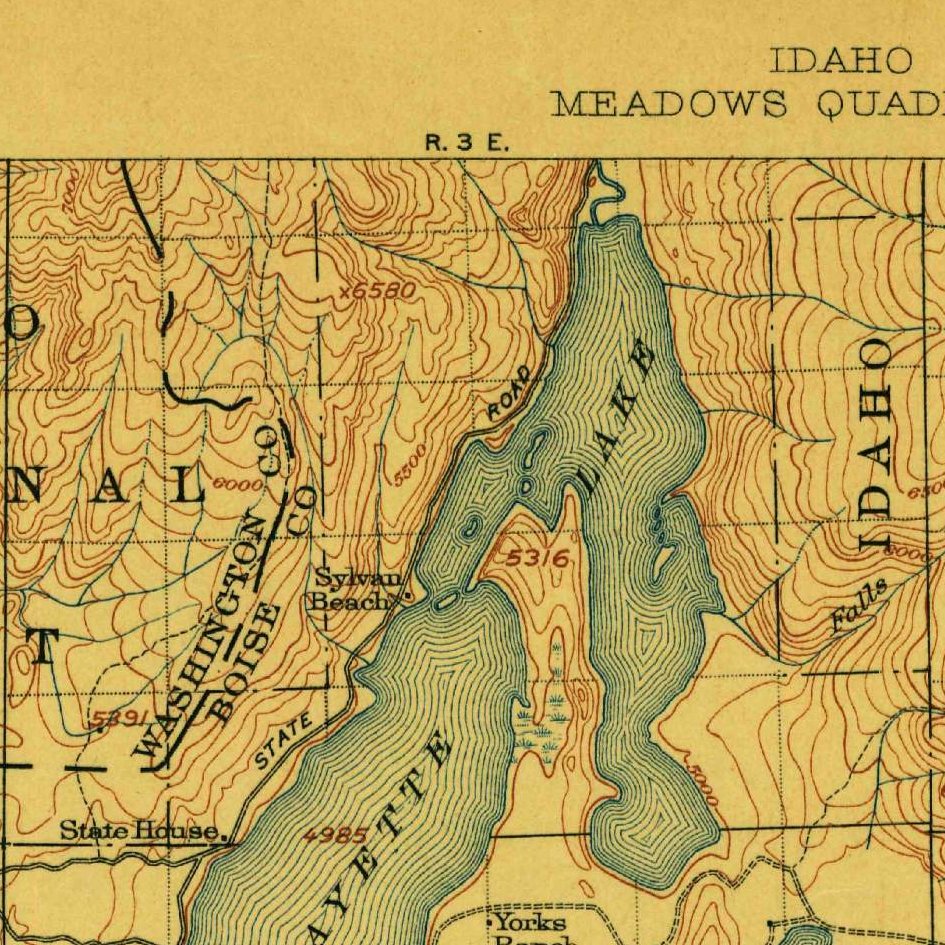
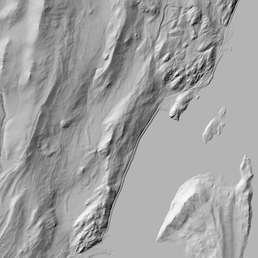
Historical & landscape images
Aerial photographs, historical topographic surveys, lidar elevation, and ground imagery gathered for this place.

How to get more images
- USGS EarthExplorer (earthexplorer.usgs.gov, free account): Aerial Photo Single Frames, NHAP (1980–89, incl. color-infrared) and NAPP (1987–2007) covering this site. Medium-resolution scans download free; high-resolution film scans cost about $30 per frame (2–3 weeks).
- USDA FSA Aerial Photography Field Office (APFO, Salt Lake City): historic county-wide farm-program photos from the 1930s on, ordered by email/phone; scans run roughly $20–$50 per frame (check current price list).
- National Archives (College Park, Cartographic Branch): 1930s–1950s USDA/AAA aerials; free to view in person, reproductions through NARA's order service or approved vendors.
- the Idaho State Archives / state historical society and the state university map library (ask about historic aerial prints and scans); the state GIS clearinghouse for lidar.
- HistoricAerials.com (NETR Online): stitched historic aerials and topos by address; downloads/prints priced per image (often about $30–$80 for personal use; commercial licensing extra).
- Commercial satellite (Maxar/Vantor, Airbus, Planet via resellers such as SkyWatch or Apollo Mapping): archive scenes from ~$10–$25/km² with small minimum orders; new tasking costs more.
- Drone flight: a local FAA Part 107 pilot typically charges about $200–$600 for a basic photo/video shoot of a parcel; ask the landowner or site manager for permission first.
This sample report was researched from public records and checked against its sources. Historical research, not title or boundary advice.
← All 50 states, places & stories · Original 50 Picks Archive · Start your own Land File